

Stonehenge walks: the best routes through the ancient landscape
Walking around Stonehenge reveals far more than the famous stone circle. Across the surrounding chalk grassland you can discover burial mounds, ceremonial avenues, the Cursus, Durrington Walls, Woodhenge and wide views across Salisbury Plain.
This guide compares the most useful Stonehenge walks, from the straightforward visitor-centre route to longer archaeological walks for experienced walkers.
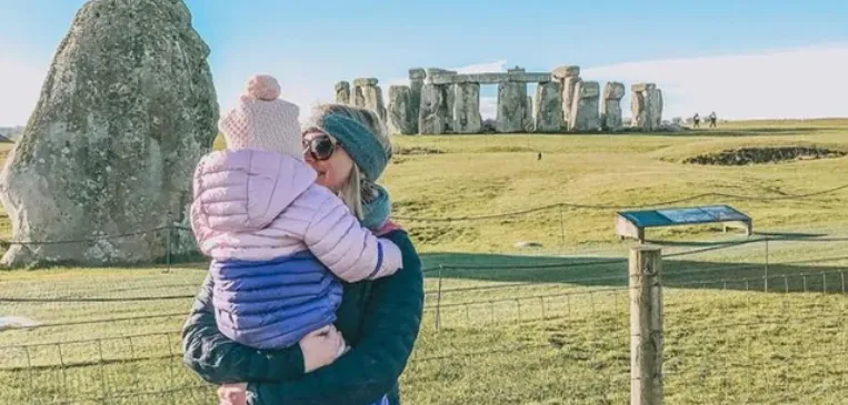
What makes walking at Stonehenge special?
The stone circle is only one part of a much larger ceremonial landscape. Walking lets you understand how Stonehenge relates to its surrounding monuments, natural ridges and ancient routes in a way that is difficult to appreciate from the visitor shuttle.
The National Trust looks after more than 800 hectares of chalk grassland within the World Heritage Site. Across the landscape are prehistoric earthworks, Bronze Age barrows, former settlements and viewpoints that place Stonehenge in its wider setting.
Paths cross open and exposed countryside. Surfaces can include hard tracks, grass, rutted byways and uneven ground, so footwear and weather preparation matter even on shorter routes.
The best Stonehenge walks
Distances and timings are approximate. Conditions, permissive access and signed routes can change, so use the latest official map and follow notices on gates when you visit.
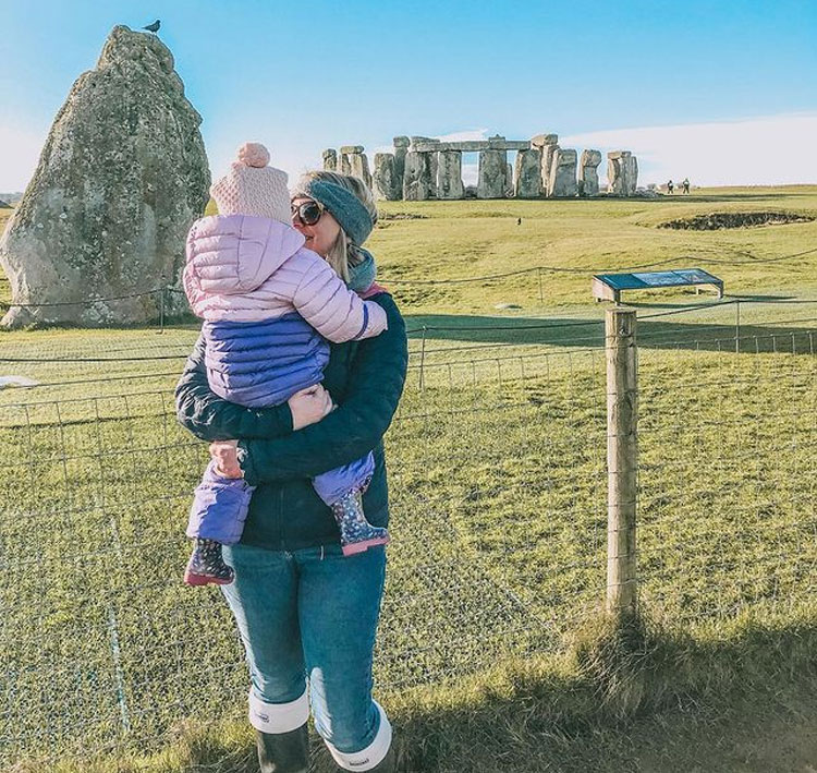 Best first walk
Visitor Centre to the Stone Circle
The simplest Stonehenge walk follows the designated route from the visitor centre to the monument. It is ideal for visitors who want to experience the open landscape without committing to a long hike.
- Follow the walker’s lane beside the visitor-bus route.
- See the monument gradually emerge within its landscape.
- Use the shuttle for one direction if you only want a partial walk.
- Get off at Fargo Plantation to walk roughly half the route.
Stonehenge King’s View circular walk
This National Trust route explores the chalk downland around Stonehenge, passing burial mounds, the Cursus, the Avenue and New King Barrows.
- Views of Stonehenge from the Cursus and New King Barrows.
- Bronze Age burial mounds and ancient beech trees.
- A section following the course of the Stonehenge Avenue.
- Uneven ground, potholes and tussocky grass in places.
Woodhenge, Durrington Walls and the Cuckoo Stone
This flexible archaeological walk explores places many Stonehenge visitors miss. Start near Woodhenge, visit Durrington Walls and continue towards the Cuckoo Stone and the wider Stonehenge landscape.
- Durrington Walls, a vast Neolithic henge and settlement area.
- Woodhenge and its reconstructed timber-circle positions.
- The Cuckoo Stone, a naturally occurring sarsen.
- Open views across the ceremonial landscape.
Treat the distance as a planning estimate rather than a fixed signed trail. Use the latest landscape map and local signage.
Amesbury to Stonehenge Down
Stonehenge Down is around two miles from Amesbury. Several approaches use byways and bridleways across Countess Farm or Coneybury Hill.
- Useful for visitors staying in Amesbury.
- Approach the World Heritage landscape on foot.
- Expect open ground, bridleways and changing field conditions.
- Plan carefully around road crossings and current access notices.
Can you walk from Stonehenge to Woodhenge?
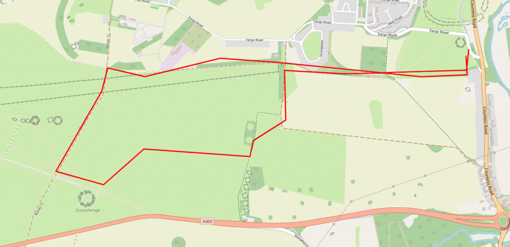
Yes. A Stonehenge-to-Woodhenge walk can be planned across the wider landscape using footpaths, bridleways and permissive routes. A return walk is roughly five miles depending on your exact start point and route.
This is not simply a transfer between two monuments. The route can connect Stonehenge with the Avenue, Cuckoo Stone, Durrington Walls and the area associated with the people who built and used the monument.
Allow at least two to three hours, carry water and use a current map. The image shown is an illustrative route from the existing guide and should not replace present-day signs or official access information.
What can you see while walking around Stonehenge?
Many of the most important features are earthworks rather than standing stones. Knowing what to look for makes the landscape far more rewarding.
The Stonehenge Cursus
A vast rectangular earthwork nearly two miles long that predates the stone circle by hundreds of years.
The Avenue
A bank-and-ditch ceremonial route more than 1.5 miles long, leading towards the stone circle.
King Barrow Ridge
Bronze Age burial mounds among ancient beech trees, with excellent views over Stonehenge and the downs.
Durrington Walls
A huge Neolithic henge associated with settlement evidence, timber structures and midwinter gatherings.
Woodhenge
A nearby Neolithic monument where concrete markers now show the positions of its former timber posts.
The Cuckoo Stone
A naturally occurring sarsen that once stood upright and appears to have remained important for centuries.
Which Stonehenge walk is best for families?
For most families, the visitor-centre-to-stone-circle route is the most manageable choice. It has a clear destination, follows the visitor route and can be shortened by using the shuttle in one direction.
Older children interested in history may enjoy the King’s View circular walk, but allow more time for uneven ground and exposed weather. The earthworks are subtle, so downloading the Stonehenge audio guide or carrying a landscape map can help bring the route to life.
Practical advice for walking around Stonehenge
Stonehenge is an open chalk landscape with limited shelter. Conditions can feel very different from those at the visitor centre.
Parking
There is no general visitor parking within the National Trust landscape. Use the English Heritage visitor centre at postcode SP4 7DE; advance booking is advisable.
Read the Stonehenge parking guideWalking with dogs
Dogs are welcome on parts of the National Trust landscape, but restrictions apply around livestock and ground-nesting birds. Follow the signs at every field entrance.
Accessibility
The visitor centre and main route use tarmac and grass paths, subject to weather. The shuttle can stop at Fargo Plantation for a partial walk.
Tickets and access
Dogs other than assistance dogs are not permitted in the monument field, exhibition or visitor buses. Admission rules are separate from landscape access.
Last reviewed: . Routes, permissive access and livestock restrictions can change, so check current National Trust and English Heritage information before travelling.
Longer walks near Stonehenge
These are not Stonehenge monument routes, but they may appeal to walkers spending more time in Wiltshire and the surrounding area.
Stourhead and Whitesheet Hill
A shorter countryside walk near Stourhead can combine woodland, an Iron Age hillfort, downland views and the historic estate.
- Approximately 3 miles depending on route.
- Allow roughly 1.5–2 hours.
- Useful as a separate Wiltshire day out.
The Clarendon Way
The Clarendon Way links Salisbury and Winchester and is a demanding full-day or multi-stage walk rather than a Stonehenge route.
- Approximately 24 miles.
- Suitable for experienced, well-prepared walkers.
- Plan transport, daylight, food and weather carefully.
Stonehenge walks FAQs
Quick answers to the questions visitors usually ask before exploring the landscape on foot.
Can you walk around Stonehenge?
Yes. You can walk from the visitor centre to the stone circle and explore many parts of the surrounding National Trust landscape using rights of way and permissive paths.
How far is the walk from the Stonehenge Visitor Centre to the stones?
The designated walk is about 1.2 miles each way and normally takes around 25–30 minutes in one direction.
Can you walk to Stonehenge without paying?
Some surrounding landscape routes have free permissive access, but this does not include the English Heritage visitor attraction, exhibition, shuttle or managed monument area. Parking and admission are separate.
What is the best circular walk at Stonehenge?
The National Trust Stonehenge King’s View walk is a well-documented 3-mile circular route taking around two hours.
Can you walk from Stonehenge to Woodhenge?
Yes. A route can be planned across the landscape using footpaths, bridleways and permissive access. A return walk is roughly five miles depending on the route chosen.
Can you walk to Stonehenge from Amesbury?
Yes. Stonehenge Down is approximately two miles from Amesbury, with approaches using byways and bridleways across the surrounding landscape.
Are Stonehenge walks suitable for children?
The visitor-centre-to-stone-circle route is the best starting point for most families because it can be shortened by using the shuttle in one direction.
Can dogs go on Stonehenge walks?
Dogs are allowed on parts of the National Trust landscape subject to local signs and livestock restrictions. Only assistance dogs are permitted in the monument field, exhibition and visitor buses.
Do I need walking boots for Stonehenge?
Sturdy shoes are adequate in dry conditions for the visitor route. Walking boots are recommended for longer routes because tracks can be muddy, rutted, uneven or covered in long grass.
Is walking around Stonehenge accessible?
The visitor centre and main monument route include tarmac and grass paths, but conditions vary with the weather. The visitor shuttle and a halfway stop at Fargo Plantation can make a partial walk possible.
Useful Stonehenge visitor guides
Plan admission, transport and interpretation before setting out on your walk.
Ready to explore Stonehenge on foot?
Choose a route that matches your available time and mobility, download a current map and check admission or parking arrangements before travelling.